Author: Shaan Abbas

  • Exploring Trango Tower: A Test of Skill and Endurance

    Exploring Trango Tower: A Test of Skill and Endurance

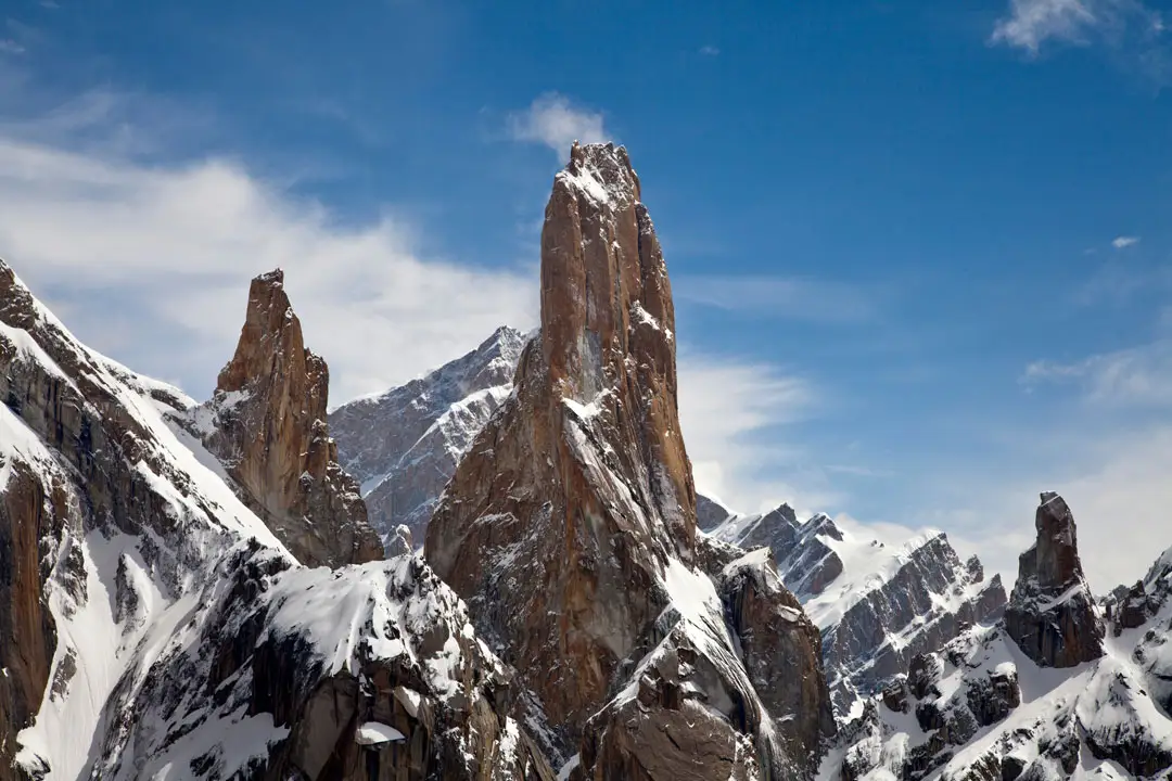
    Nestled in the heart of Northern Pakistan, Trango Tower (often referred to as The Great Trango Tower) is one of the most iconic peaks in the world. Towering at an impressive 6,286 meters (20,604 feet), this monumental granite spire is a geological marvel and one of the most formidable challenges for mountaineers and trekkers alike. As you approach its vertical rock faces, Trango Towers offers an experience that pushes physical limits and mental strength. This blog will take you on a journey to explore Trango Tower, detailing the challenges of climbing, trekking, and the breathtaking views around this majestic mountain in Gilgit-Baltistan, Pakistan.

    Trango Tower: A Geographical and Climatic Wonder

    What Makes Trango Tower So Unique?

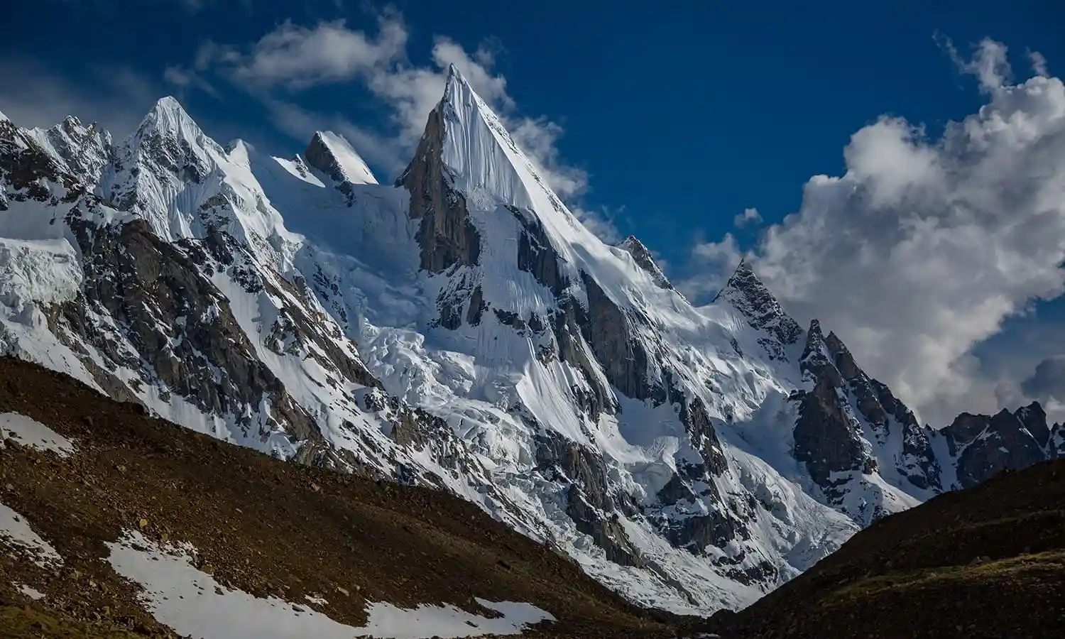
    Trango Tower is a prominent feature within the Baltoro Glacier, part of the Karakoram Range. It is part of the Trango Towers group, including other striking peaks like Trango Nameless Tower. The sheer vertical drop of Trango Tower makes it one of the most challenging mountains to climb, attracting climbers worldwide, including Alex Honnold, who has shared his fascination with the Trango Towers climbing routes.

    The Trango Towers’ height and steep rock faces make it a prime target for serious climbers. The imposing granite walls of the Great Trango Tower are renowned for their difficulty, with technical climbing routes such as the Eternal Flame Trango Tower offering some of the most challenging ascents. The American Route on the Great Trango Tower is a popular but difficult option for those seeking the ultimate climbing challenge.

    The First Ascent: A Milestone in Climbing History

    In 1976, American climbers Jim Donini, John Roskelley, and Jay Wilson were the first to ascend Trango Tower. This landmark ascent began the tower’s reputation as one of the world’s most challenging climbs. However, even seasoned mountaineers face significant challenges, and the deaths of the Trango Towers are a sobering reminder of the dangers that climbers confront in this harsh environment.

    The Trango Towers base camp, at an elevation of about 4,200 meters (13,780 feet), is the first stop for climbers hoping to tackle the Great Trango Tower. The journey to the summit is grueling from here, with multiple technical climbs and harsh weather conditions.

    trango-towers-expedition

    Trekking to Trango Tower Base Camp

    The Journey to Trango Tower

    Reaching Trango Tower requires an adventurous trek starting from Islamabad, Pakistan’s capital city. From Islamabad, trekkers take a flight to Skardu. This strategic hub offers access to some of the most iconic trekking routes in the world, including the trek to Trango Towers.

    From Skardu, the route to Askole—the last village accessible by road—begins. From here, the trek to Trango Tower base camp takes 8 to 10 days, taking trekkers through rugged landscapes, glacier crossings, and magnificent views of some of the tallest peaks in the Karakoram.

    Key Stops Along the Trek:

    • Askole: The gateway to the Karakoram, marking the beginning of the trek.
    • Jhola: A beautiful stop near the Biafo Glacier.
    • Urdukas: A campsite offering spectacular views of surrounding peaks.
    • Goro II: A high-altitude camp offering an excellent perspective on Trango Tower and nearby peaks.

    Throughout this trek, trekkers will be exposed to the unpredictable Karakoram weather. Snowstorms, extreme cold, and high-altitude winds are common. The best trekking season is from June to September when conditions are more stable.

    The Challenges of Climbing Trango Tower

    The Technical Difficulty of the Climb

    Trango Towers climbing is known for its immense technical difficulty. The ascent to the Trango Tower summit involves rock climbing, ice climbing, and navigating mixed terrain. The sheer faces, which rise to almost 1,000 meters in some parts, make it one of the most challenging climbs in the world. Climbers often face rockfalls, avalanches, and unpredictable weather, which makes climbing Trango Towers Pakistan a perilous yet rewarding feat.

    One of the most famous routes on the Great Trango Tower is the Eternal Flame, a stunning 700-meter (2,300-foot) vertical wall that draws expert climbers worldwide. The climb is demanding, and its position near the top of the tower requires precision and stamina.

    The vertical drop of Trango Towers is legendary, with some sections presenting near-perfect sheer rock faces that require serious climbing skills. For free soloists like Alex Honnold, the prospect of conquering Trango Tower without ropes is not unimaginable. However, it remains one of the most dangerous forms of climbing.

    Risks Involved: Deaths and Accidents

    As is often the case with such extreme climbs, Trango Towers has had deaths over the years. The death rate is lower than some other peaks, but the risk remains high, particularly in the technical sections of the climb. Avalanches, rockslides, and falls are real threats, and proper training and experience are essential before attempting such a climb.

    Despite the risks, the rewards of reaching the Trango Towers summit are unparalleled. Climbers who succeed experience a unique connection to the natural world, standing atop one of the most awe-inspiring views in the Karakoram range.

    trango-towers_Climbing

    The Fascination of Free Soloing Trango Tower

    One of the most thrilling aspects of climbing Trango Towers is the allure of free solo climbing. Climbers like Alex Honnold have made headlines with their daring solo ascents of some of the world’s most challenging peaks. While free soloing Trango Tower may seem impossible, it is an aspiration for many climbers who seek to conquer the tower’s vertical granite walls without ropes.

    Nearby Destinations to Explore in the Karakoram

    While Trango Tower is the main attraction, the Karakoram region offers many other destinations. After tackling the Trango Towers trek, trekkers can explore these nearby wonders:

    K2 Base Camp Trek

    Located just a short distance from Trango Tower, the K2 Base Camp is another must-see destination for serious trekkers. K2 is the second-highest mountain in the world, and trekking to its base camp offers close-up views of Broad Peak, Gasherbrum I, and Gasherbrum II. The trek through the Baltoro Glacier to K2 is challenging, but the stunning vistas make it worthwhile.

    Hunza Valley: A Serene Escape

    After completing your challenging trek or climb, unwind in the serene Hunza Valley, known for its lush greenery and picturesque landscapes. This tranquil region provides an ideal place to relax and enjoy the stunning natural beauty of Northern Pakistan. Hunza Valley is also home to historical sites like Baltit Fort and Altit Fort, offering fascinating insights into the local culture and history.

    Deosai National Park

    Known as the “Land of Giants”, Deosai National Park is a high-altitude plateau situated near the Karakoram Range. This park offers vast open spaces, stunning alpine meadows, and a wide array of wildlife. Trekking through Deosai is an unforgettable experience, with vistas of snow-capped peaks in the background.

    great trango tower

    The Best Time to Visit Trango Tower

    Weather Considerations for Climbers and Trekkers

    The weather at Trango Tower is one of the most challenging aspects of the journey. Due to the high-altitude environment, the weather can be unpredictable, with temperature fluctuations ranging from freezing cold at higher altitudes to warmer temperatures at base camp. The Great Trango Tower is often covered in snow and ice, making it an even more formidable challenge during winter. However, the winter ascent of Trango Tower is a rare and remarkable accomplishment for experienced climbers.

    The best time for climbing or trekking to Trango Tower is June to September. The weather is relatively more stable during these months, with clear skies and moderate temperatures. The Trango Tower base camp is often a starting point for trekking expeditions during this period, ensuring that climbers and trekkers can complete their journey in the most favourable conditions.

    Conclusion: A Journey to Remember

    Trango Tower is a mountaineer’s dream, an iconic peak that challenges every climber who dares to attempt it. From the trek to the base camp to the technical difficulties of the climb itself, Trango Tower is a test of endurance, skill, and determination. Its proximity to K2, the Karakoram mountains, and the beauty of the Baltoro Glacier make it one of the world’s most extraordinary adventures.

    Whether you aim to reach the Trango Tower summit or simply trek to its base, the journey to Trango Towers is an experience you will never forget. Karakoram Pakistan awaits—let the adventure of a lifetime begin!

  • Gasherbrum I: The Hidden Giant of the Karakoram

    Gasherbrum I: The Hidden Giant of the Karakoram

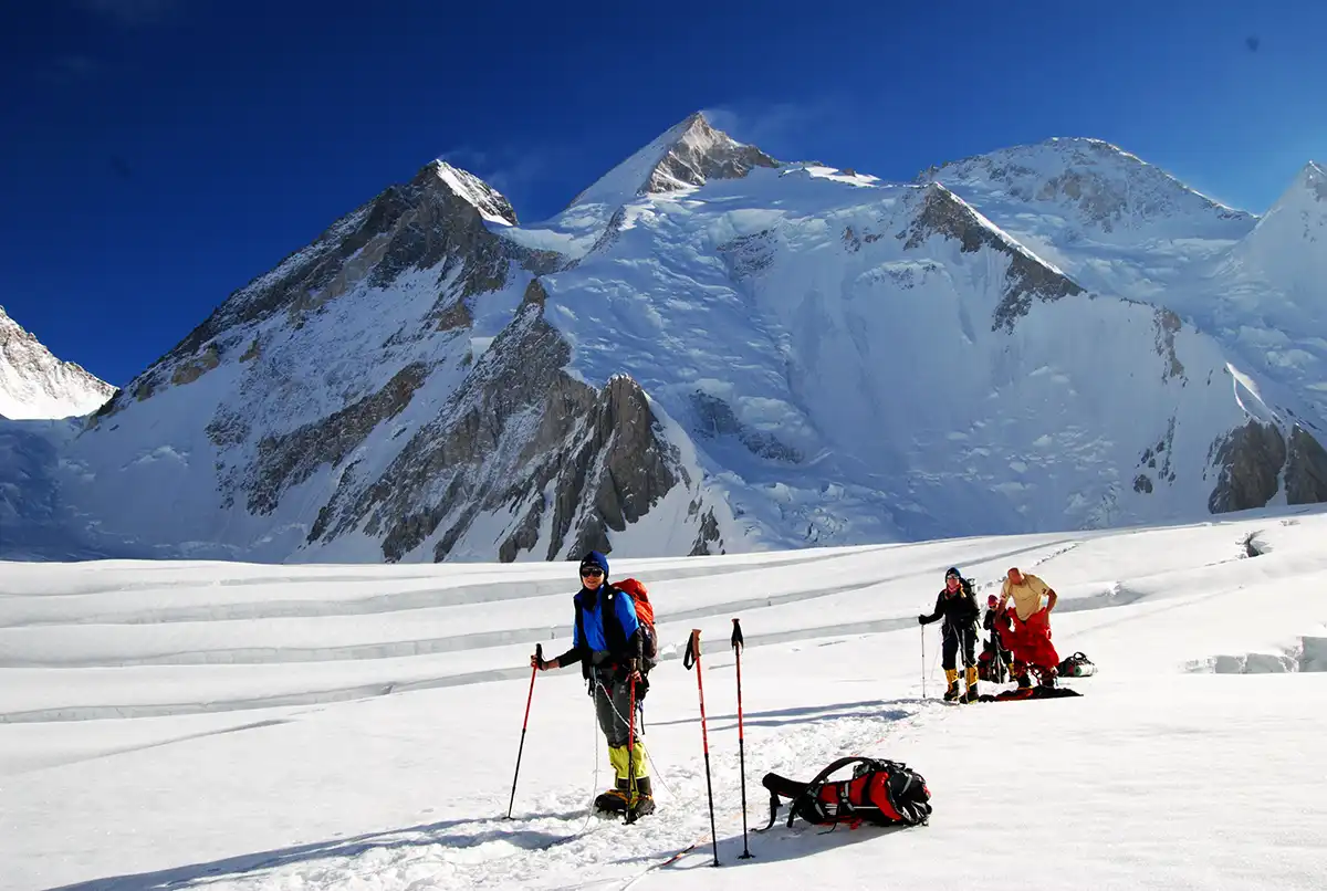
    Nestled deep in the towering Karakoram mountain range of northern Pakistan, Gasherbrum I stands as one of Earth’s most majestic and remote peaks. Often overshadowed by its more famous neighbours like K2 and Nanga Parbat, Gasherbrum I (7,070 meters / 23,000 feet) remains a hidden gem that has captivated adventurers, mountaineers, and trekkers worldwide. If you’re seeking an unforgettable adventure in the rugged landscapes of Pakistan, Gasherbrum I offers a world-class trekking experience and an unparalleled chance to witness some of the most pristine, awe-inspiring beauty on the planet. Here’s everything you need to know about this remarkable destination.

    Introduction to Gasherbrum I

    Gasherbrum I, also known as the “Hidden Peak,” is the 11th-highest peak on Earth, located in the remote and isolated region of Gilgit-Baltistan in northern Pakistan. Part of the more immense Gasherbrum I and II massif, this majestic peak is often referred to as the “Hidden Peak” due to its somewhat lesser-known status compared to its towering neighbours. Despite its relative obscurity, it is a favourite among seasoned mountaineers drawn to its challenging climbs and stunning vistas. For trekkers, the trek to Gasherbrum I Base Camp offers an opportunity to witness unparalleled natural beauty and engage with one of the world’s most awe-inspiring mountain environments.

    The Gasherbrum I’s height of 7,070 meters (23,000 feet) and elevation make it a challenging peak for climbers, yet its beauty and sheer scale make it a top destination for trekking enthusiasts from around the globe.

    How to Reach Gasherbrum I

    Getting to Gilgit-Baltistan

    Your adventure to Gasherbrum I begins in Islamabad, the capital city of Pakistan. From here, you must fly to Gilgit, the gateway to the Karakoram region. Alternatively, you can take a scenic yet thrilling road trip from Islamabad to Gilgit, which takes about 12 hours. The journey will take you through breathtaking landscapes, crossing valleys and passing villages nestled along rivers.

    Travel to Askole

    Once in Gilgit, the next step is to drive to Askole, the starting point of the trek to Gasherbrum I. Askole is a small village located at the edge of the wilderness and serves as the base for most expeditions. The road to Askole is challenging, particularly after the Karakoram Highway ends, requiring a 4×4 vehicle. From Askole, the trekking journey to Gasherbrum I Base Camp begins.

    Gasherbrum-II-expedition

    Trekking to Gasherbrum I Base Camp

    Trek Overview

    The trek to Gasherbrum I Base Camp is a challenging and rewarding experience that usually takes 10-12 days to complete. The route is physically demanding and mentally stimulating, as trekkers will encounter diverse landscapes, shifting weather patterns, and high-altitude conditions.

    The trek starts at Askole and continues through the Braldu Valley, eventually reaching the majestic Baltoro Glacier. This massive, ancient glacier forms the centrepiece of the trek, offering dramatic views of towering peaks, including Broad Peak, Gasherbrum IV, and, of course, Gasherbrum I itself. The path to the base camp is rugged and includes streams, rocky moraines, and icy terrain.

    Key Stops Along the Way

    • Askole to Jhola (5-6 hours): The trek starts with a relatively easy hike along the Braldu River, passing through villages, dense forests, and grassy fields. You’ll spend the night at Jhola, a small settlement where trekkers can relax and enjoy their first glimpse of the towering peaks ahead.
    • Jhola to Paiju (7-8 hours): The hike becomes more demanding as you approach Paiju, a green oasis surrounded by vast glaciers. Paiju is an ideal place to acclimate and rest before the more challenging days. It offers spectacular views of the surrounding mountains, including the distinctive peaks of the Baltoro Glacier.
    • Paiju to Urdukas (8-9 hours): Trekking past the Baltoro Glacier’s moraine, you’ll reach Urdukas, one of the most scenic campsites along the way. Trekkers get their first accurate view of Gasherbrum I, rising majestically in the distance.
    • Urdukas to Goro II (6-7 hours): Continuing along the glacier, the terrain becomes more demanding, with occasional stretches of ice and crevasses to navigate. Goro II is a place to set up camp and prepare for the final push towards the base camp.
    • Goro II to Gasherbrum Base Camp (7-8 hours): You’ll finally reach Gasherbrum I Base Camp after trekking. The awe-inspiring view of the peak, with its snow-capped summit piercing the sky, makes all the effort worth it. It’s a surreal experience to stand beneath this towering giant and soak in the stunning panoramas.

    The Challenge of High Altitude

    At an altitude of around 5,100 meters (16,732 feet), the Gasherbrum Base Camp is firmly in the high-altitude zone, where trekkers can experience symptoms of altitude sickness. ItSpendingers spend several days acclimatizing at key points along highly recommended routes. The high-altitude environment means that trekkers should be prepared for varying weather conditions, from scorching heat during the day to freezing cold at night.

    Gasherbrum II 1 Gasherbrum I

    Attractions Around Gasherbrum I

    Baltoro Glacier

    The Baltoro Glacier is one of the longest glaciers outside the polar regions. It offers some of the most stunning views in the Karakoram Range. As you trek, the glacier stretches, with jagged peaks and ice formations creating an awe-inspiring scene. This massive glacier is the heart of the Gasherbrum region, and its vast expanse is a photographer’s dream. Many of the best pics of Gasherbrum I have taken around this glacier showcase the pristine beauty of the landscape.

    Concordia: The Meeting Point of the Giants

    Concordia is not far from Gasherbrum Base Camp. On this legendary spot, trekkers are treated to one of the most spectacular panoramic views in the world. From this vantage point, you can see the towering peaks of K2, Broad Peak, and Gasherbrum IV. It is a famous stopping point for trekkers aiming to see multiple iconic peaks of the Karakoram in one view.

    Nearby Peaks: Broad Peak & Gasherbrum IV

    While Gasherbrum I is the show’s star, trekkers also get to glimpse nearby peaks such as Broad Peak (8,051 meters) and Gasherbrum IV (7,925 meters). These towering summits are part of the larger Gasherbrum I and II massif and contribute to the region’s rugged beauty.

    Gasherbrum I Routes and Challenges

    The ascent of Gasherbrum I is a technical and challenging undertaking, with climbers typically following the Gasherbrum I K5 route. Known for its steep ice faces and rock climbing sections, the Gasherbrum I routes require high skill and experience. Due to its challenging nature, the Gasherbrum I K5 death rate has been historically high, making it one of the more dangerous climbs in the Karakoram range. However, it remains a highly sought-after destination for expert mountaineers, especially those looking to conquer peaks beyond the popular K2.

    Best Time to Visit Gasherbrum I

    The best time to trek to Gasherbrum I is during the summer months of June to September. The weather is relatively stable during this period, and the chances of encountering heavy snowstorms are minimal. However, trekkers should still be prepared for rapidly changing conditions. They should always carry the necessary gear to handle cold temperatures, rain, or wind.

    gasherbrum  expedition
    gasherbrum expedition

    What to Pack for the Trek

    Since Gasherbrum I is a high-altitude trek, packing the right gear is crucial to ensuring a safe and comfortable experience. Here’s a quick checklist of what to bring:

    • Clothing: Layered clothing, including moisture-wicking base layers, thermal layers, a down jacket, and a waterproof shell jacket.
    • Footwear: Sturdy, high-quality trekking boots, gaiters, and extra socks for comfort.
    • Accessories: Sunglasses, sunblock, a hat for sun protection, and gloves for warmth.
    • Camping Gear: A lightweight, high-altitude tent, a sleeping bag rated for freezing temperatures, and a stove.
    • Trekking Equipment: Trekking poles, a headlamp, a first-aid kit, and a water purification system.

    Nearby Attractions

    For those looking to extend their stay in northern Pakistan, the region offers many nearby attractions perfect for tourists and trekkers. Popular destinations in the vicinity include:

    • Hunza Valley: Known for its lush green landscapes, ancient forts, and the towering Rakaposhi peak, Hunza is a paradise for trekkers, offering a relaxing break after the rigorous Gasherbrum I trek.
    • Skardu: A central hub for trekking in the Karakoram Range, Skardu provides access to several treks, including the trek to K2 Base Camp, and is known for its stunning natural beauty.
    • Deosai National Park: Located between Skardu and Gilgit, Deosai is the second-highest plateau in the world, known for its wildflower meadows and unique wildlife.

    Conclusion: Why Gasherbrum I Should Be on Your Bucket List

    Gasherbrum, I may not be as famous as K2, but it is awe-inspiring. Its remote location, the incredible landscapes of the Karakoram Range, and the challenge of reaching its base camp make it an unparalleled adventure for trekkers and mountaineers. Whether you’re seeking a once-in-a-lifetime trekking experience or a chance to witness the majestic beauty of one of the world’s highest peaks, Gasherbrum I promises to deliver memories that will last a lifetime.

    If you’re ready to take on one of the world’s most challenging and beautiful treks, buckle up your seat belts and get ready to explore the Hidden Giant of the Karakoram!

  • Gasherbrum II: Adventure at the Edge of the World

    Gasherbrum II: Adventure at the Edge of the World

    In the Karakoram mountain range, Gasherbrum II is one of the most majestic peaks in the world. Standing at an impressive 8,035 meters (26,362 feet), it is the 13th-highest mountain on Earth. While it may not get as much fame as K2, Gasherbrum II offers a unique adventure that attracts mountaineers, trekkers, and thrill-seekers from around the globe. Its towering height, challenging terrain, and stunning landscapes make it a prime destination for those who crave high-altitude challenges and remote beauty.

    Whether you’re looking to trek to the base camp, attempt the summit, or explore the surrounding region, Gasherbrum II offers an unforgettable journey. In this blog, we’ll discuss the experiences that await you on the Gasherbrum II expedition, the physical and mental challenges involved, and nearby destinations worth exploring.

    Gasherbrum II: The Mountain of Beauty and Danger

    The Grandeur of Gasherbrum II

    Gasherbrum II, also known by some as “”Mount Godwin Austen”“, is part of the Gasherbrum massif in the Karakoram Range. It is positioned near Gasherbrum I, and together, they form one of the most formidable mountain pairs in the world. Many climbers who take on the challenge of climbing Gasherbrum II also consider tackling Gasherbrum I, the 11th tallest peak in the world.

    The Gasherbrum II’s height and symmetrical shape have earned it the nickname “”Mountain of Beauty,”” standing tall amidst the rugged Karakoram. The journey to the summit is not for the faint-hearted, with climbers and trekkers facing extreme weather, treacherous paths, and high-altitude dangers. However, the views along the way are mesmerizing, with panoramic vistas of surrounding peaks like Broad Peak, K2, and Gasherbrum I visible from the Gasherbrum II base camp.

    The Route to Gasherbrum II Base Camp

    To begin your adventure to Gasherbrum II, you first need to go to Skardu, the gateway to the Karakoram range. A jeep ride takes you to Askole, the last inhabited settlement before the trail begins. The trek through the Baltoro Glacier is long, taking you through places like Paiju, Urdukas, and Goro II, each offering extraordinary views of the surrounding mountains.

    Key Stops Along the Trek:

    • Skardu: The primary starting point for your trek.
    • Askole: A small settlement where your trek begins, situated at the confluence of the Braldo and Biafo Glaciers.
    • Paiju: A stunning spot near the glacier, perfect for setting up camp and acclimatizing.
    • Urdukas: One of the highest camps along the Baltoro Glacier trek.

    After several days of trekking, you’ll arrive at Gasherbrum II base camp, which provides breathtaking views of the mountain’s towering face. At 5,300 meters (17,400 feet), it is the base for climbers attempting the Gasherbrum II summit.

    gasherbrum i expedition
    gasherbrum i expedition

    Challenges on the Trail: The Difficulty of Gasherbrum II

    The Gasherbrum II Difficulty: A High-Altitude Trek

    The difficulty of Gasherbrum II cannot be overstated. The combination of altitude, extreme cold, and technical terrain presents a challenge even for seasoned mountaineers. As you move higher on the trek, the lack of oxygen makes every step more taxing, and altitude sickness is a real risk. While the trek to the base camp is less technical, it’s still physically demanding. As trekkers ascend, the temperatures plummet, and the cold of Gasherbrum II becomes a serious factor.

    The cold of Gasherbrum II is notorious among climbers. From snowstorms to freezing winds, the environment tests your endurance. The trek offers little shelter from the harsh elements, and only those prepared for severe conditions can succeed. Many climbers planning to tackle Gasherbrum II’s summit spend weeks acclimatizing to the cold and high-altitude environments to avoid altitude sickness and frostbite.

    Gasherbrum II Avalanche and Its Dangers

    The Gasherbrum II avalanche remains one of the mountain’smountain’s most dangerous features. Avalanches are common on high-altitude peaks like Gasherbrum II and have taken many lives over the years. Trekkers and climbers must be extra cautious in the avalanche-prone areas, particularly around Banana Ridge Gasherbrum II, which is notorious for being prone to avalanches. In fact, many of the Gasherbrum II bodies that have been left behind on the mountain were victims of avalanches, underscoring the mountain’s deadly nature.

    Climbing Gasherbrum II: The Summit Challenge

    The Ultimate Goal: Gasherbrum II Summit

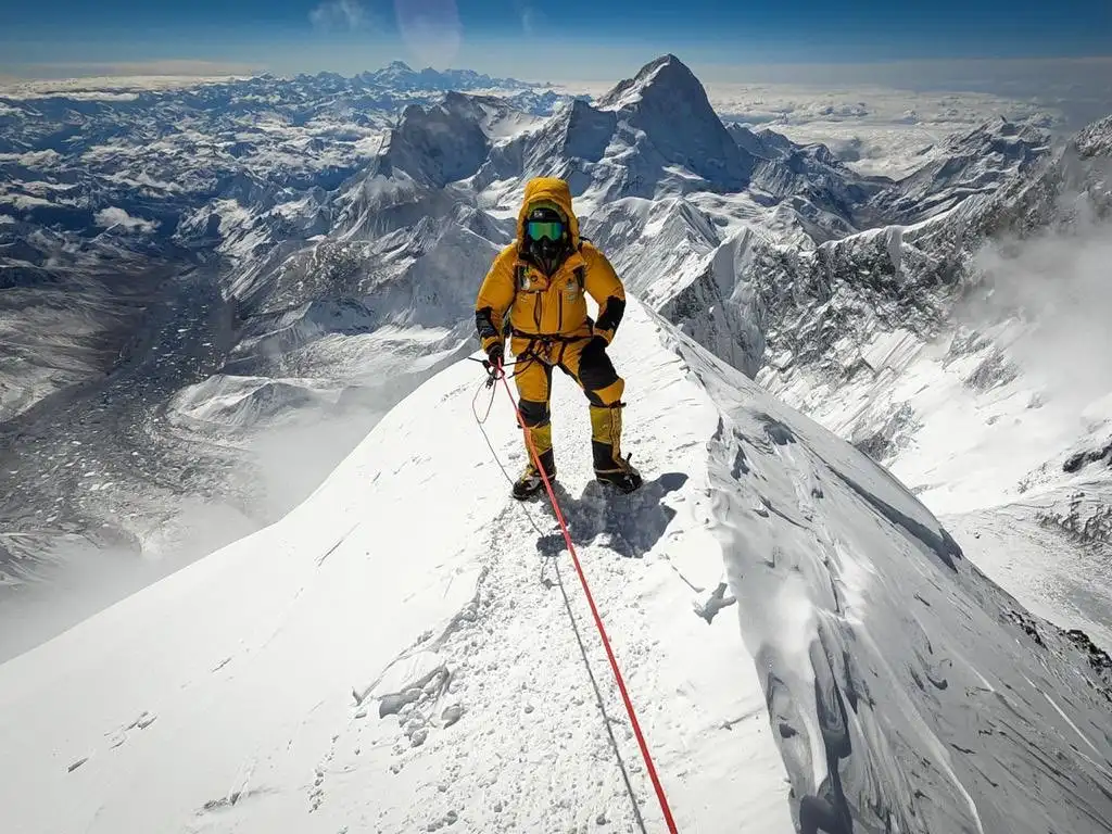
    The Gasherbrum II summit is one of the world’s most sought-after prizes for mountaineers. Reaching the top is an incredible achievement but comes with significant risks. Climbing Gasherbrum II requires careful planning, months of preparation, and the experience to navigate its unpredictable weather and treacherous terrain.

    The final push toward the Gasherbrum II summit is particularly challenging. Climbers must contend with steep slopes, crevasses, and extreme cold. The technical difficulty of climbing Gasherbrum II has earned it a reputation as one of the most challenging 8,000-meter peaks. The Banana Ridge Gasherbrum II is one such spot where climbers face the sharpest inclines and are forced to use ropes, ice axes, and crampons to navigate the climb safely.

    gasherbrum i expedition
    gasherbrum i expedition

    Gasherbrum II Death Rate: The Harsh Reality

    As with any high-altitude climb, Gasherbrum II deaths are a reality. The death rate is a grim reminder of the mountain’s inherent danger. Climbers face a range of risks, from avalanches to falls and altitude sickness. Climbers who are unprepared for the harsh conditions or underestimate the mountain’s difficulties are often at risk. Notable incidents, such as losing Gasherbrum II Camp 4 bodies in avalanches or extreme conditions, have added to the peak’s dangerous legacy.

    Despite the risks, many climbers have successfully summited Gasherbrum II, and the reward of reaching the top is considered one of the most exhilarating accomplishments in mountaineering.

    Cory Richards and Gasherbrum II

    One climber who has captured the imagination of the mountaineering community regarding Gasherbrum II is Cory Richards. His adventure and photos from the Gasherbrum II expedition in 2016 have been widely shared, bringing attention to the mountain’s beauty and challenge. Richards’ documentary work, including the Cold Gasherbrum II movie, showcases the extremes of mountaineering, making it clear how the mountain and the environment shape every climber’s journey.

    Best Time to Visit Gasherbrum II

    When to Trek Gasherbrum II

    The best time to visit Gasherbrum II is between June and September, as these months offer the most favourable weather conditions. The Gasherbrum II weather in these months is generally milder, with clearer skies and warmer temperatures than in the winter months. Climbers and trekkers can more easily navigate the paths without the harsh conditions of snowstorms or freezing winds.

    However, the months between November and March offer opportunities for daring to attempt the Gasherbrum II winter ascent, though this is highly risky and generally reserved for seasoned professionals. The ascent requires not only immense skill but also the ability to cope with extreme cold and challenging weather.

    gasherbrum i expedition
    gasherbrum i expedition

    Nearby Attractions to Explore

    While Gasherbrum II is the primary draw, the surrounding region offers a wealth of natural beauty and cultural attractions.

    1. K2 Base Camp

    Just a few days ‘ trek from Gasherbrum II, the K2 Base Camp trek is one of the most iconic in the world. It offers trekkers breathtaking views of K2, the world’s second-highest peak. The trek also provides access to Gasherbrum I and II opinions, giving trekkers a unique perspective on the surrounding peaks.

    2. Hunza Valley

    Known for its serene landscapes, Hunza Valley is a picturesque region in Gilgit-Baltistan. It’s perfect for unwinding after your arduous trek to Gasherbrum II. Enjoy the valley’s natural beauty, visit historic sites like Baltit Fort, and experience the warmth of the local people.

    3. Shigar Fort

    Situated near Skardu, Shigar Fort offers a blend of history and beauty. Once home to the region’s local rulers, the fort now serves as a boutique hotel. It is a fantastic place to learn about the region’s culture and history while enjoying stunning views of the surrounding mountains.

    Conclusion: The Ultimate Adventure

    The trek to Gasherbrum II tests endurance, mental strength, and climbing skills. From the challenging Gasherbrum II climb to the summit’s final push, the journey is filled with obstacles, but the rewards are unparalleled. Whether you’re aiming for the Gasherbrum II summit, trekking to the base camp, or simply exploring the Karakoram range, this adventure promises to be one of the most thrilling experiences of your life.

    If you’re ready to take on the challenge, Gasherbrum II awaits—standing as a true adventure at the world’s edge. Buckle up, and let’s begin!

  • Lady Finger Peak Trek: Best Time to Visit

    Lady Finger Peak Trek: Best Time to Visit

    Nestled in the scenic Hunza Valley, Lady Finger Peak is one of the most captivating landmarks in Northern Pakistan. Known for its sharp, spire-like shape and awe-inspiring beauty, Lady Finger Peak in Pakistan offers an unmatched trekking experience that draws adventurers from across the globe. With an elevation of 6,000 meters (19,685 feet), it stands as a towering testament to the grandeur of the Karakoram Range.

    This blog will provide an in-depth guide to visiting Lady Finger Peak, including insights into the best times to plan your trek, what makes this peak unique, and the treasures of the surrounding region. Whether you’re an experienced trekker or a first-time visitor to Hunza Valley, this article will help you make the most of your journey to one of Pakistan’s most iconic destinations.

    An Introduction to Lady Finger Peak

    Lady Finger Peak: A Natural Icon in Pakistan

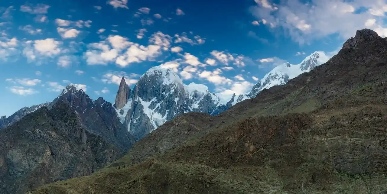
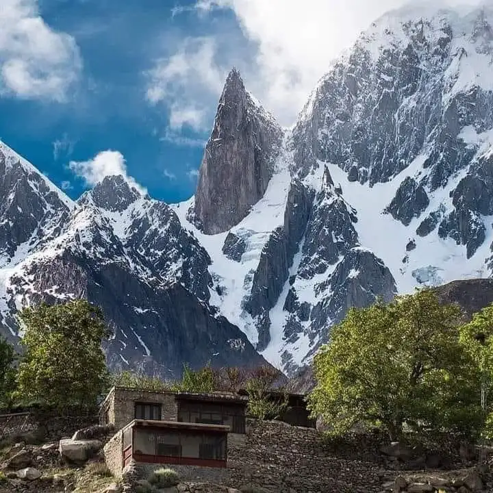
    Lady Finger Peak in Pakistan, also known locally as Bublimotin, is part of the Ultar Sar massif in the Karakoram Range. The name “Lady Finger” comes from its slender, pointed appearance, which resembles an upraised finger against the sky. Its unique shape and towering height make it a highly recognizable and frequently photographed peak. For many travellers, Lady Finger Peak Hunza is not just a trekking destination but a symbol of the region’s rugged and pristine beauty.

    The Height of Lady Finger Peak

    Standing at 6,000 meters (19,685 feet), the Lady Finger Peak height places it among the notable summits of the Karakoram Range. While not as tall as some of its neighbours, its striking profile and the stunning views it offers make it a compelling destination for trekkers and mountaineers alike.

    Where Is Lady Finger Peak Located?

    Lady Finger Peak is present in Northern Pakistan, specifically in the Hunza Valley. It lies within the Gilgit-Baltistan region, known for its dramatic landscapes, towering mountains, and welcoming local communities. For those wondering in which country Lady Finger Peak is located, the answer is clear: Pakistan is a land of immense natural beauty and home to some of the world’s most impressive mountain ranges.

    lady finger peak
    lady finger peak

    Why Visit Lady Finger Peak?

    A Unique Trekking Experience

    Trekking to Lady Finger Peak base camp offers more than just a hike; it’s a journey into a world of dramatic landscapes, rich cultural heritage, and awe-inspiring views. Unlike more crowded trekking routes, the Lady Finger Peak trek allows adventurers to experience tranquillity and solitude amidst nature’s raw beauty.

    The surrounding Hunza Valley provides a stunning backdrop for the trek. From the terraced fields and orchards at lower elevations to the rugged cliffs and glaciers near the peak, every step of the journey offers something remarkable.

    The Best Time to Visit Lady Finger Peak

    Seasonal Highlights and Weather Considerations

    Choosing the right season is crucial for your trek to Lady Finger Peak Hunza. The best times to visit are spring (April to June) and autumn (September to November). During these months, the weather is generally stable, the views are clear, and the trails are more accessible.

    Spring: A Burst of Color

    In spring, the valley comes alive with blooming wildflowers and lush greenery. Milder temperatures and clear skies make it ideal for trekking. The combination of vibrant landscapes and the peak’s golden hues at sunrise and sunset creates a truly magical experience.

    Autumn: Golden Views

    Autumn is known for its crisp, cool air and stunning foliage. The trees in the Hunza Valley turn shades of gold and orange, strikingly contrasting Lady Finger Peak’s grey rock. With fewer trekkers on the trails, you can enjoy a more peaceful and immersive journey.

    Winter and Summer: Challenges and Rewards

    While winter (December to March) brings heavy snowfall and freezing temperatures, it also offers a unique perspective for those willing to brave the cold. On the other hand, summer (July to August) can bring monsoon rains and cloudy conditions. Still, it also showcases the valley’s lush greenery at its peak.

    lady finger peak
    lady finger peak

    The Lady Finger Peak Trek: A Detailed Guide

    Starting Point: Karimabad

    The trek to Lady Finger Peak base camp begins in Karimabad, a historic and culturally rich town in the Hunza Valley. Before setting out, trekkers can explore Baltit Fort and Altit Fort, two architectural marvels that glimpse the region’s past. Karimabad is also a perfect place to acclimate, as it sits at an altitude of 2,500 meters (8,200 feet).

    The Trail to Lady Finger Peak

    The trek gradually ascends from Karimabad, passing through terraced fields, small villages, and rocky trails. The path winds past the Ultar Glacier, providing dramatic views of glacial streams and rugged terrain. As trekkers climb higher, they are rewarded with increasingly close views of Lady Finger Peak and its neighbouring summits, such as Ultar Sar and Rakaposhi.

    Key Highlights Along the Route:

    1. Terraced Fields and Orchards:
    2. The lower sections of the trail are dotted with apricots, apples, and cherry orchards that bloom beautifully in spring.
    3. Rugged Rocky Terrain:
    4. Higher up, the landscape transitions into rocky ridges and scree slopes, adding an adventurous element to the trek.
    5. Base Camp Vantage Point:
    6. The final viewpoint offers stunning close-up views of Lady Finger Peak, framed by the glaciers and peaks of the Ultar Sar massif.

    Nearby Attractions in Hunza Valley

    Rakaposhi Base Camp

    A trek to the Rakaposhi Base Camp provides a different perspective of the Hunza Valley. The massive Rakaposhi Glacier and serene meadows make this trek a perfect complement to your journey to Lady Finger Peak.

    Ultar Glacier

    Located near Lady Finger Peak, the Ultar Glacier is another must-see destination. The glacial formations and pristine ice fields offer a unique and photogenic setting.

    Passu Cones

    A short drive from Karimabad, the Passu Cones are a photographer’s dream. Their jagged, triangular peaks are unlike anything else in the region and are easily accessible for a quick excursion.

    Baltit Fort and Altit Fort

    These historic forts in Karimabad glimpse the region’s rich cultural heritage. Their strategic locations offer incredible views of the surrounding peaks and valleys.

    Preparing for the Lady Finger Peak Trek

    Physical Fitness and Acclimatization

    Although the Lady Finger Peak trek is considered moderate in difficulty, it still requires reasonable fitness. Spending a few days in Karimabad beforebefore the trek can help trekkers acclimate to the altitude and ensure a safer, more enjoyable journey.

    Essential Gear for the Trek

    Packing the right gear is crucial for a successful trek. Key items include:

    • Sturdy hiking boots
    • Warm clothing layers
    • Waterproof jacket
    • Trekking poles
    • Sleeping bag and tent (if camping)
    • High-energy snacks
    • A camera to capture the breathtaking scenery

    Tips for a Memorable Visit

    1. Hire a Local Guide:
    2. A local guide can provide valuable insights into the region’s culture, history, and natural features.
    3. Start Early:
    4. Trekking in the early morning ensures you’ll enjoy the best light for photography and cooler temperatures.
    5. Stay Hydrated and Take Breaks:
    6. The altitude and challenging terrain can be tiring. Drink plenty of water and pace yourself.
    7. Respect Local Customs:
    8. The Hunza Valley is known for its warm hospitality, but respecting local traditions and dressing modestly is essential.
    9. Leave No Trace:
    10. Help preserve the pristine environment by taking all your waste and staying on marked trails.

    Conclusion: Why You Should Visit Lady Finger Peak

    Lady Finger Peak is not just a trek; it’s an adventure that combines stunning natural beauty, cultural richness, and a sense of accomplishment. From the best times to visit to the scenic trails and historic landmarks of the Hunza Valley, every aspect of the journey promises a memorable experience.

    If you’re drawn to the towering Lady Finger Peak height, curious about the country where Lady Finger Peak is present, or simply looking for an off-the-beaten-path destination, this trek will not disappoint. So pack your bags, choose the perfect season, and set out to discover one of Pakistan’s most iconic peaks.

  • Lady Finger Peak and the Hunza Valley: A Perfect Combination for Trekkers

    Lady Finger Peak and the Hunza Valley: A Perfect Combination for Trekkers

    Nestled in the heart of northern Pakistan, the Hunza Valley and Lady Finger Peak stand as two of the country’s most breathtaking natural wonders. For trekkers and nature enthusiasts alike, this combination offers an unrivalled adventure that blends awe-inspiring landscapes with rich cultural heritage. Whether you’re looking to tackle a challenging trek or immerse yourself in the serenity of this mountain paradise, Hunza Valley and Lady Finger Peak will captivate you.

    Exploring the Hunza Valley: A Hidden Gem in Northern Pakistan

    Hunza Valley is one of the most mesmerizing destinations in Pakistan. Located in the Gilgit-Baltistan region, it is famous for its lush green valleys, dramatic mountain landscapes, and warm, welcoming people. The valley is surrounded by towering peaks like Rakaposhi, Ultar Sar, and Lady Finger Peak, offering trekkers an ideal base for exploration.

    How to Reach Hunza Valley

    • By Road: The most popular route is from Gilgit, about 100 kilometres away. You can drive along the famous Karakoram Highway (KKH), renowned as the Eighth Wonder of the World. The drive offers stunning views of the valleys, rivers, and mountains, ensuring the journey is as scenic as the destination.
    • By Air: Alternatively, you can fly into Gilgit from Islamabad. The flight offers a bird’s-eye view of the majestic mountain ranges surrounding the region.

    Cultural Heritage and Hospitality of Hunza

    Hunza Valley isn’t just about its natural beauty; it’s also steeped in rich culture and history. The valley is home to the Burusho people, who speak their language and are deeply connected to the land. Visitors to Hunza can experience the unique traditions and customs of the people, as well as visit historical sites like:

    • Baltit Fort Hunza: A historical fort that offers stunning views of the valley and gives visitors a glimpse into the region’s royal past.
    • Altit Fort: One of the oldest forts in the region, offering spectacular views and a chance to learn about the history of Hunza.
    lady finger peak
    lady finger peak

    Lady Finger Peak: The Crown Jewel of Hunza Valley

    Standing tall at Lady Finger Peak, a height of 6,000 meters (19,685 feet), Lady Finger Peak is one of Hunza’s most iconic landmarks. Its distinctive shape resembles a finger pointing toward the sky, making it easily recognizable from a distance. Often referred to as “Rakaposhi’s little sister,” it is part of the Rakaposhi mountain range, the 27th highest peak in the world.

    Trekking to Lady Finger Peak: A Challenge for Adventurers

    The trek to Lady Finger Peak is a challenging yet rewarding experience. While summiting the peak requires mountaineering skills, trekkers can enjoy stunning views of the surrounding glaciers, valleys, and towering peaks. Here’s what you can expect from this trek:

    • Trekking Difficulty is moderate to challenging, especially as you gain altitude. It requires physical endurance, as the trek can take up to five days to complete.
    • Scenic Routes: The trail winds through alpine meadows, forests, and rugged terrain, with panoramic views of the peaks and glaciers.
    • Glaciers and Rivers: Your journey will include crossing glaciers and glacial rivers, which will add an element of excitement and adventure.

    For those who prefer to experience Lady Finger Peak’s beauty from a distance, several viewpoints around Hunza Valley offer incredible views of the peak.

    Best Time to Visit Hunza Valley and Lady Finger Peak

    The optimal time to visit Hunza Valley and trek to Lady Finger Peak is April and October. During this period, the weather is perfect for trekking, with clear skies and moderate temperatures. However, each season offers a different perspective:

    • Spring (April – June): Wildflowers bloom, and the valley is lush greenery.
    • Summer (July – August): This is the peak season, with the valley fully alive and bustling with tourists. The weather is warm, making it ideal for outdoor activities.
    • Autumn (September – October): The valley is adorned in golden hues as the leaves turn colour, making it one of the most picturesque times to visit.
    lady finger peak

    Nearby Attractions in Hunza Valley

    While Lady Finger Peak is the main draw, Hunza Valley has a wealth of other attractions worth visiting. Here are some of the must-see spots in the region:

    1. Karimabad: The Heart of Hunza

    Karimabad Hunza is the main town in Hunza and serves as the best base for trekkers. It is situated on a plateau and offers spectacular views of Rakaposhi and Lady Finger Peak.

    • Key Attractions in Karimabad:
      • Baltit Fort Hunza: A historic fort over 700 years old, offering panoramic views and a glimpse into Hunza’s past.
      • Altit Fort: A historical monument offering scenic views and an insight into Hunza’s royal history.

    2. Passu Cones: A Photographer’s Paradise

    The Passu Cones are a series of jagged peaks that rise dramatically from the landscape. Their pointed shape makes them one of the most iconic landmarks in Hunza. Located near the Karakoram Highway, the Passu Cones are perfect for photography, especially during sunrise and sunset when the light casts an ethereal glow on the peaks.

    3. Attabad Lake: The Turquoise Beauty

    Attabad Lake, formed after a massive landslide in 2010, is one of the region’s most beautiful bodies of water. The lake’s turquoise waters, surrounded by steep mountain slopes, create a serene environment for boat rides and photography. It’s a peaceful escape after a day of trekking and an essential stop for all visitors to Hunza.

    4. Khunjerab Pass: The Roof of the World

    Khunjerab Pass, situated at an altitude of 4,714 meters (15,466 feet), is one of the highest border crossings in the world. The pass offers stunning views of snow-capped peaks on the Pakistan-China border and serves as an essential route for international trade and tourism.

    Where to Stay in Hunza Valley

    Hunza Valley offers a variety of accommodations, ranging from basic guesthouses to luxurious hotels. Depending on your preferences and budget, you’ll find something to suit your needs. Some popular accommodations include:

    • Eagle Nest Hunza: A mid-range hotel with breathtaking views of the surrounding mountains.
    • Hunza Serena Hotel: Offering excellent amenities and a cosy atmosphere, perfect for trekkers.
    • Luxus Hunza Attabad Lake Resort: A luxury resort located near Attabad Lake, known for its modern amenities and scenic surroundings.
    Lady finger peak

    Essential Tips for Trekkers

    To make the most of your trek to Lady Finger Peak and your time in Hunza Valley, keep these essential tips in mind:

    • Prepare Physically: Ensure you’re in good physical shape before embarking on the trek. Cardiovascular fitness and strength training are necessary for a successful journey.
    • Pack Smart: Don’t overpack; focus on essentials such as a sturdy pair of trekking boots, layered clothing for various weather conditions, and a good camera.
    • Hire a Guide: Local guides can make your trek more enjoyable and informative. They are familiar with the terrain and can provide valuable insights into the region’s history and culture.
    • Altitude Considerations: While the trek to Lady Finger Peak does not involve a summit climb, it’s essential to take acclimatization seriously. Take your time to adjust to higher altitudes and stay hydrated.

    Sustainable Travel in Hunza Valley

    Hunza Valley is becoming increasingly susceptible to environmental stress as a popular tourist destination. Here’s how you can minimize your impact while enjoying the region:

    • Reduce Plastic Waste: Carry reusable water bottles and minimize single-use plastic.
    • Respect Local Culture: Be mindful of local customs, dress modestly, and ask permission before photographing locals.
    • Support Eco-Friendly Businesses: Choose accommodations and tour operators prioritizing sustainability and eco-friendly practices.

    Conclusion: A Journey Worth Taking

    The Hunza Valley and Lady Finger Peak are must-sees for trekkers and nature lovers. Their stunning landscapes, rich culture, and adventurous treks make this destination one of the top choices for anyone seeking an unforgettable adventure in northern Pakistan. Whether you’re looking to challenge yourself on the trek to Lady Finger Peak or soak in the valley’s beauty, Hunza Valley offers an experience that will stay with you long after you’ve left.So, what are you waiting for? Pack your bags, lace up your trekking boots, and embark on a journey that will forever be etched in your memory. Hunza Valley and Lady Finger Peak are calling—are you ready to answer?

  • Hispar Glacier: A Journey Into Pakistan’s Untouched Wilderness

    Hispar Glacier: A Journey Into Pakistan’s Untouched Wilderness

    Located in the remote northern reaches of Pakistan, the Hispar Glacier is one of the world’s most stunning and untouched natural wonders. Situated in the heart of the Karakoram Range, this magnificent glacier is surrounded by towering peaks, rugged landscapes, and a pristine environment. For trekkers and adventurers seeking a truly remote and challenging experience, Hispar Glacier offers an unforgettable journey into one of the world’s most dramatic and awe-inspiring regions.

    In this blog, we’ll explore everything you need to know about Hispar Glacier, from its location, length, and weather to the amazing trekking routes and the stunning views that await you on this expedition.

    Introduction to Hispar Glacier

    The Hispar Glacier is one of the longest glaciers in the Karakoram Range and one of Pakistan’s most significant natural landmarks. It stretches approximately 50 kilometers (31 miles), making it an immense and awe-inspiring sight. The glacier is situated in Nagar Valley, near Hunza, a region known for its breathtaking beauty and towering peaks.

    The Hispar Glacier location is located in the remote regions of Gilgit-Baltistan, where the rugged landscape of Hunza meets the towering peaks of the Karakoram Range. The glacier lies just below some of the highest mountains in the world, including Rakaposhi (7,788 meters) and Batura Sar (7,762 meters). The glacier is known for its remote setting, dramatic ice formations, and pristine, untouched environment.

    Getting to Hispar Glacier: How to Start Your Adventure

    By Air: Islamabad to Gilgit

    To start your journey to Hispar Glacier, you must first travel to Gilgit, the nearest city to Hunza. The most common way to reach Gilgit is by flying from Islamabad, with Pakistan International Airlines (PIA) offering regular flights. The flight duration is about an hour and provides passengers with stunning aerial views of the Karakoram Range and its towering peaks, such as Nanga Parbat and Rakaposhi.

    By Road: Gilgit to Karimabad

    Once you arrive in Gilgit, you will take a road trip to Karimabad, the main town in Hunza. The journey takes about 2-3 hours, and the road offers beautiful views of the valley, the Hunza River, and traditional mountain villages.

    Trekking to Hispar Glacier

    After reaching Karimabad, you will travel to Hispar village by jeep, which will take approximately 6-7 hours through bumpy and rugged terrain. Upon arrival in Hispar, your Hispar Glacier trek will begin. The trek is physically demanding, requiring trekkers to navigate through crevasses, icy terrain, and towering glaciers.

    hispar glacier

    What to Expect on the Hispar Glacier Trek

    The Hispar Glacier trek is known for its beauty and its challenges. As one of the most remote and difficult treks in the Karakoram Range, this journey will take you deep into the wilderness of Hunza and Nagar Valley.

    Day 1: Hispar to Batura Glacier

    Your journey begins at Hispar village, where you will start trekking towards Batura Glacier, a major ice field that connects with the Hispar Glacier. This part of the trek takes you through small villages, lush valleys, and along fast-flowing rivers. As you hike through this terrain, the towering peaks of Rakaposhi and Batura Sar will gradually come into view.

    Day 2-3: Batura Glacier to Hispar Glacier

    On the second day, you will begin your ascent onto the Batura Glacier, which eventually merges with the Hispar Glacier. This is where you’ll begin to experience the rugged and icy terrain that makes the Hispar Glacier such a challenging trek. The Hispar Glacier weather is cold, with temperatures often dropping below freezing at night, and you’ll be trekking over vast stretches of ice and snow.

    The Hispar Glacier temperature can vary depending on the time of year, but the weather remains harsh throughout the year, especially in the higher altitudes of the glacier. During the summer, daytime temperatures range from 5°C to 15°C, but the nights can drop significantly, making the trek even more challenging.

    Day 4-5: Crossing the Hispar Glacier

    As you traverse the Hispar Glacier, you will encounter crevasses, icefalls, and towering ice structures that make this part of the journey both challenging and awe-inspiring. The Himal Glacier facts reveal that it is one of the longest glaciers in the region, and its icy landscape offers a truly remote and spectacular trekking experience. The trek across the glacier takes a couple of days, requiring careful navigation through tricky ice and rocky paths.

    Day 6: Hispar Glacier to Hispar La

    The final stretch of the trek will lead you to Hispar La, a high-altitude pass situated at 5,150 meters (16,896 feet). This summit offers a spectacular panoramic view of the surrounding peaks, including Rakaposhi and Batura Sar. The climb to Hispar La is demanding, but the view of the Hispar Glacier and the surrounding Karakoram Range is stunning once at the top.

    biafo hispar glacier

    What Makes Hispar Glacier Special?

    Pristine Natural Beauty

    The Hispar Glacier is one of the most pristine glaciers in the world. Due to its remote location, it has remained untouched by human development and offers trekkers a rare opportunity to explore a landscape that is as natural as it gets. The Hispar Glacier photos and Hispar Glacier images show dramatic landscapes, ice cliffs, crevasses, and the immense beauty of the glacier that stretches as far as the eye can see.

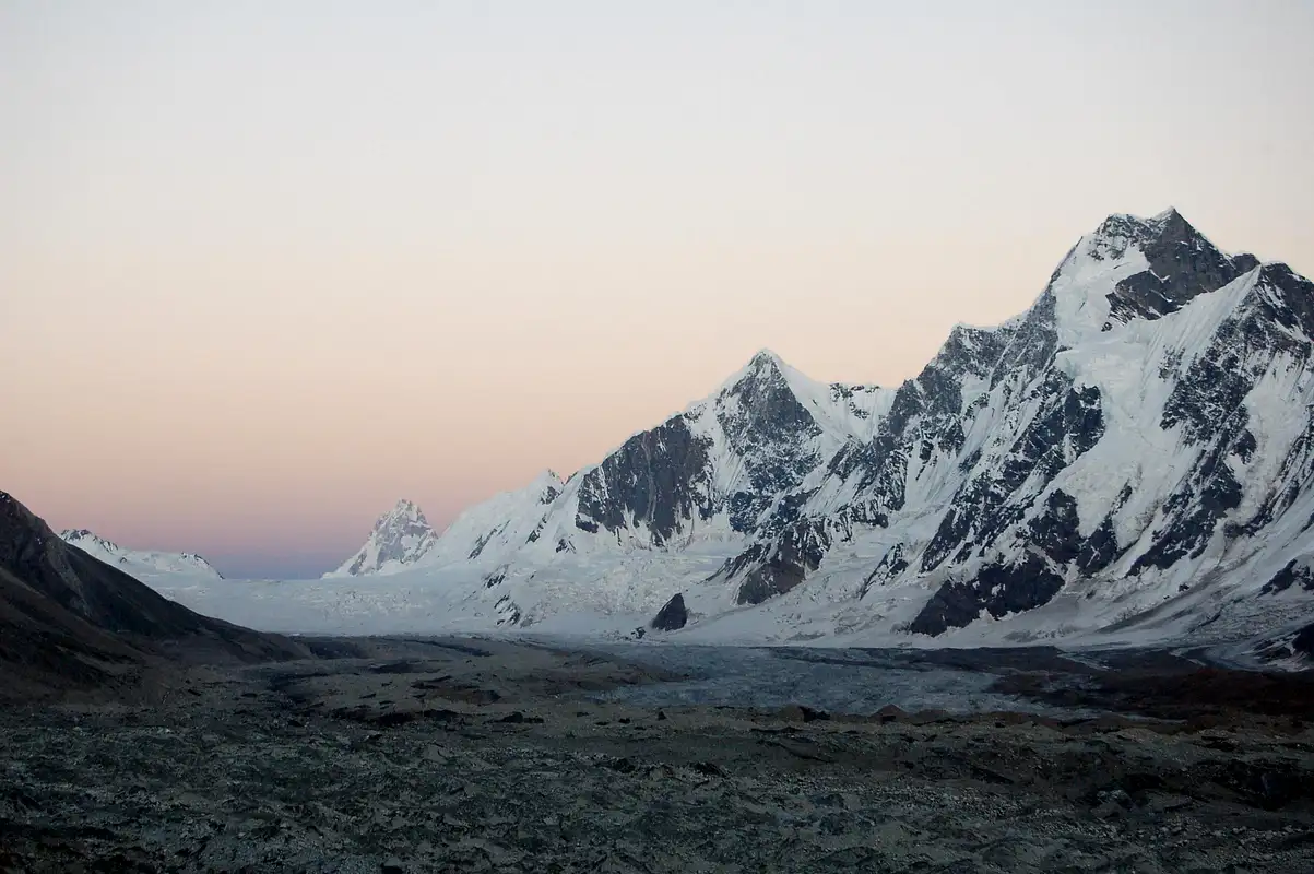
    The Biafo Hispar Glacier system, which combines the Hispar Glacier and the Biafo Glacier, is the longest glacial system in Pakistan and one of the longest in the world. It is an extraordinary feature of the Karakoram Range, and its sheer size and grandeur make it one of the most unique destinations for trekkers.

    A Remote Adventure

    One of the most captivating aspects of trekking on Hispar Glacier is the sense of isolation and remoteness. The Hispar Glacier is far off the beaten path, making it an ideal destination for those who seek solitude and an authentic wilderness experience. You won’t encounter many trekkers along the way, and you’ll be fully immersed in the magnificent wilderness of the Karakoram Range.

    The Challenge of Glacier Trekking

    The difficulty of the Hispar Glacier trek is high due to the icy terrain, crevasses, and altitude. Trekkers must be physically fit and have previous experience with glacier trekking, as navigating through ice and snow requires technical skills and careful attention to safety. The trek is physically demanding, but it rewards trekkers with some of the most spectacular views on Earth.

    Hispar Glacier Facts and Figures

    • Length of Hispar Glacier: Approximately 50 kilometers (31 miles), making it one of the longest glaciers in the region.
    • Hispar Glacier Location: Nagar Valley, Gilgit-Baltistan, in the Karakoram Range.
    • Hispar Glacier Temperature: Temperatures on the glacier can drop significantly at night, often reaching -10°C or lower, while daytime temperatures can range from 5°C to 15°C.
    • Hispar Glacier Surge: Like many glaciers, Hispar Glacier has experienced surges, making its movement and behavior a fascinating subject for geologists.
    • Hispar Glacier Weather: The weather on the glacier is cold year-round, with harsh conditions at higher altitudes. The best time to visit is from June to September, when the weather is relatively milder.
    hispar glacier

    Best Time to Visit Hispar Glacier

    The best time to visit Hispar Glacier is during the summer, from June to September, when the Hispar Glacier weather is relatively stable, and the ice is more manageable. During this period, the trek is more accessible, and trekkers can easily navigate the glacier. However, it is important to note that the temperatures can still be cold, especially at higher altitudes.

    Nearby Attractions to Explore

    Once you have completed the Hispar Glacier trek, there are several nearby destinations worth exploring:

    • Hunza Valley: Known for its beautiful landscapes and rich culture, Hunza is a must-visit destination. The valley offers scenic spots like Baltit Fort, Eagle’s Nest, and Rakaposhi Viewpoint.
    • Naltar Valley: Famous for its lush forests, crystal-clear lakes, and scenic landscapes, Naltar is an excellent place to unwind after a challenging trek.
    • Deosai National Park: Known as the “Land of Giants,” Deosai offers vast plains and stunning views of surrounding peaks.

    Conclusion

    The Hispar Glacier is a trek for the true adventurer, offering unparalleled beauty and a journey through one of the world’s most remote and dramatic landscapes. The glacier’s massive size, rugged terrain, and pristine environment make it a bucket-list destination for trekkers and mountaineers. With its breathtaking views of the Karakoram Range, challenging glacier trekking, and a sense of isolation, the Hispar Glacier trek provides an unforgettable adventure into Pakistan’s untouched wilderness. Whether you’re a seasoned trekker or a passionate adventurer, the Hispar Glacier will leave you with memories of a lifetime.

  • K2 Gondogoro La Trek: The Ultimate High-Altitude Challenge

    K2 Gondogoro La Trek: The Ultimate High-Altitude Challenge

    The K2 Gondogoro La Trek presents a breathtaking challenge for trekkers and mountaineers seeking the ultimate adventure. Situated in the Karakoram Range of northern Pakistan, this trek takes you to the base of K2, the second-highest peak in the world. It crosses the Gondogoro La Pass, one of the most difficult high-altitude passes. Combining stunning glaciers, towering peaks, and the raw beauty of the mountains, this trek promises an unforgettable experience for those who are up for the challenge.

    In this blog, we will take you through all the essential details of the K2 Gondogoro La Trek, including how to get there, what to expect on the journey and the remarkable landscapes that make this trek one of the most extraordinary in the world.

    Introduction to K2 Gondogoro La Trek

    The Gondogoro La Trek is a trek to K2 Base Camp and a passage over the famous Gondogoro La Pass, which stands at 5,585 meters (18,300 feet). This trek offers an unparalleled combination of high-altitude trekking, stunning views of the world’s most iconic peaks, and a truly remote and challenging experience. The trek leads you through some of the most pristine regions of the Karakoram Range, including Concordia, which is considered one of the most scenic viewpoints in the world, offering a panoramic view of peaks like K2, Broad Peak, and Gasherbrum IV.

    The K2 Gondogoro La Trek is often described as the ultimate high-altitude challenge due to its difficult terrain and the sheer beauty it presents to trekkers.

    How to Reach the K2 Gondogoro La Trek: Getting Started

    The K2 Base Camp and Gondogoro La Trek begin from Askole, a small village in Skardu that serves as the gateway to the Karakoram Range. Trekkers usually fly to Skardu from Islamabad to get to Askole. The flight is the quickest way to reach Skardu and offers stunning views of the Karakoram Range and surrounding mountain peaks.

    k2 gondogoro la trek

    By Air: Islamabad to Skardu

    Regular flights from Islamabad to Skardu are available through Pakistan International Airlines (PIA), and the scenic flight offers breathtaking views of snow-capped peaks and valleys. The duration of the flight is about one hour, offering a beautiful introduction to the high-altitude trek that lies ahead.

    By Road: Skardu to Askole

    Once you arrive in Skardu, you will take a jeep ride of about 6-7 hours to Askole, the starting point of the trek. The rugged and bumpy road offers stunning views of valleys and villages, preparing you for the incredible scenery that awaits on the trek.

    The K2 Gondogoro La Trek: A Detailed Itinerary

    Day 1: Askole to Jhola (6-7 Hours)

    The trek begins in Askole, and the first day’s journey is through lush green valleys, charming villages, and the rugged terrain of Basho Valley. By evening, you will arrive at Jhola, a small campsite by the Basho River. This area is a peaceful spot to rest and prepare for the more challenging trek sections.

    Day 2: Jhola to Paiju (5-6 Hours)

    From Jhola, the trek heads towards Paiju, which sits at the base of Paiyu Peak. Today’s trek takes you along the Baltoro Glacier, providing fantastic views of Broad Peak and Gasherbrum IV. The Paiju campsite is one of the most popular spots on the trek due to its stunning views and the surrounding glaciers.

    Day 3: Paiju to Urdukas (5-6 Hours)

    Continuing along the Baltoro Glacier, you will reach Urdukas, a stunning campsite surrounded by towering peaks, including Gasherbrum II and Gasherbrum IV. The Urdukas camp is located at 4,200 meters (13,780 feet), making it an important acclimatization stop on the trek.

    gondogoro la pass
    gondogoro la pass

    Day 4-5: Urdukas to Concordia (8-9 Hours)

    From Urdukas, trekkers will head towards Concordia, the convergence point of the Baltoro and Godwin-Austen Glaciers. This is one of the most famous spots on the trek, often referred to as the “Throne Room of the Mountain Gods” due to the breathtaking views of K2, Broad Peak, and Gasherbrum IV. Concordia is a photographer’s paradise, offering panoramic views of some of the most magnificent peaks in the world.

    Day 6: Concordia to K2 Base Camp (4-5 Hours)

    A short trek from Concordia will take you to K2 Base Camp at 5,150 meters (16,896 feet). From here, you will have a clear view of K2, the second-highest peak on Earth. The base camp is located at the foot of the Karakoram Glacier, and standing at the base of such a towering peak is an awe-inspiring experience.

    Day 7-8: Concordia to Gondogoro La (8-10 Hours)

    The next part of the trek is the most challenging as you ascend towards Gondogoro La. The climb to the pass requires determination and stamina, as it involves steep sections and glaciated terrain. The Gondogoro La Pass is one of the most difficult sections of the trek, but the reward is worth every step. From the summit of the Gondogoro La Pass, trekkers are treated to an awe-inspiring panoramic view of K2, Broad Peak, Gasherbrum IV, and several other iconic peaks of the Karakoram Range.

    Day 9-10: Descent to Hushe (6-7 Hours)

    After crossing the Gondogoro La Pass, trekkers begin the descent towards Hushe, a village in the Nagar Valley. The journey to Hushe is relatively easier, offering fantastic views of the surrounding peaks. Upon arrival in Hushe, trekkers can relax and reflect on the incredible adventure that has just unfolded.

    What Makes the K2 Gondogoro La Trek Special?

    High-Altitude Adventure

    The Gondogoro La Trek is a high-altitude journey that pushes trekkers to their limits. With an ascent to the Gondogoro La Pass at 5,585 meters, trekkers must be physically prepared and capable of handling high-altitude trekking conditions. The Gondogoro La difficulty level is high due to the steep inclines and icy terrain, but the reward of crossing the pass is unparalleled.

    Majestic Views of K2 and Other Peaks

    The views from Concordia, K2 Base Camp, and Gondogoro La are among the best in the world. Trekkers are treated to spectacular views of K2, Broad Peak, Gasherbrum IV, and other peaks from various vantage points along the trek. The sight of K2 from Concordia is often described as a bucket-list moment for trekkers and mountaineers alike.

    Remote and Untouched Beauty

    The K2 Gondogoro La Trek takes trekkers through some of the world’s most pristine regions, offering a rare glimpse of nature in its untouched form. From the icy expanse of the Baltoro Glacier to the alpine meadows and remote valleys, the trek showcases the raw beauty of the Karakoram Range.

    Best Time to Trek the K2 Gondogoro La

    The best time to embark on the K2 Gondogoro La Trek is during the summer months, between June and September. During this period, the weather is more stable, and the chances of encountering snowstorms or heavy rainfall are lower. Temperatures at Gondogoro La can drop below freezing at night, so trekkers should be prepared with the right gear for cold conditions.

    Nearby Attractions

    Once you have completed the K2 Gondogoro La Trek, you can explore other nearby destinations in the region:

    • Deosai National Park: Known as the “Land of Giants,” Deosai offers stunning views of rolling plains and the surrounding peaks.
    • Satpara Lake: A serene lake near Skardu, surrounded by majestic mountains.
    • Naltar Valley: Famous for its lush greenery and serene lakes, Naltar is a beautiful relaxing spot after your trek.

    Conclusion

    The K2 Gondogoro La Trek is the ultimate high-altitude challenge for trekkers and mountaineers looking to push their limits. From the breathtaking views of K2 to the challenging climb over the Gondogoro La Pass, this trek is an adventure of a lifetime. With spectacular landscapes, pristine glaciers, and an unspoiled environment, the K2 Gondogoro La Trek offers some of the most stunning mountain views in the world. The K2 Gondogoro La Trek will provide an unforgettable experience if you are ready for the challenge.

  • Rakaposhi: Conquering the Heights of Hunza’s Iconic Peak

    Rakaposhi: Conquering the Heights of Hunza’s Iconic Peak

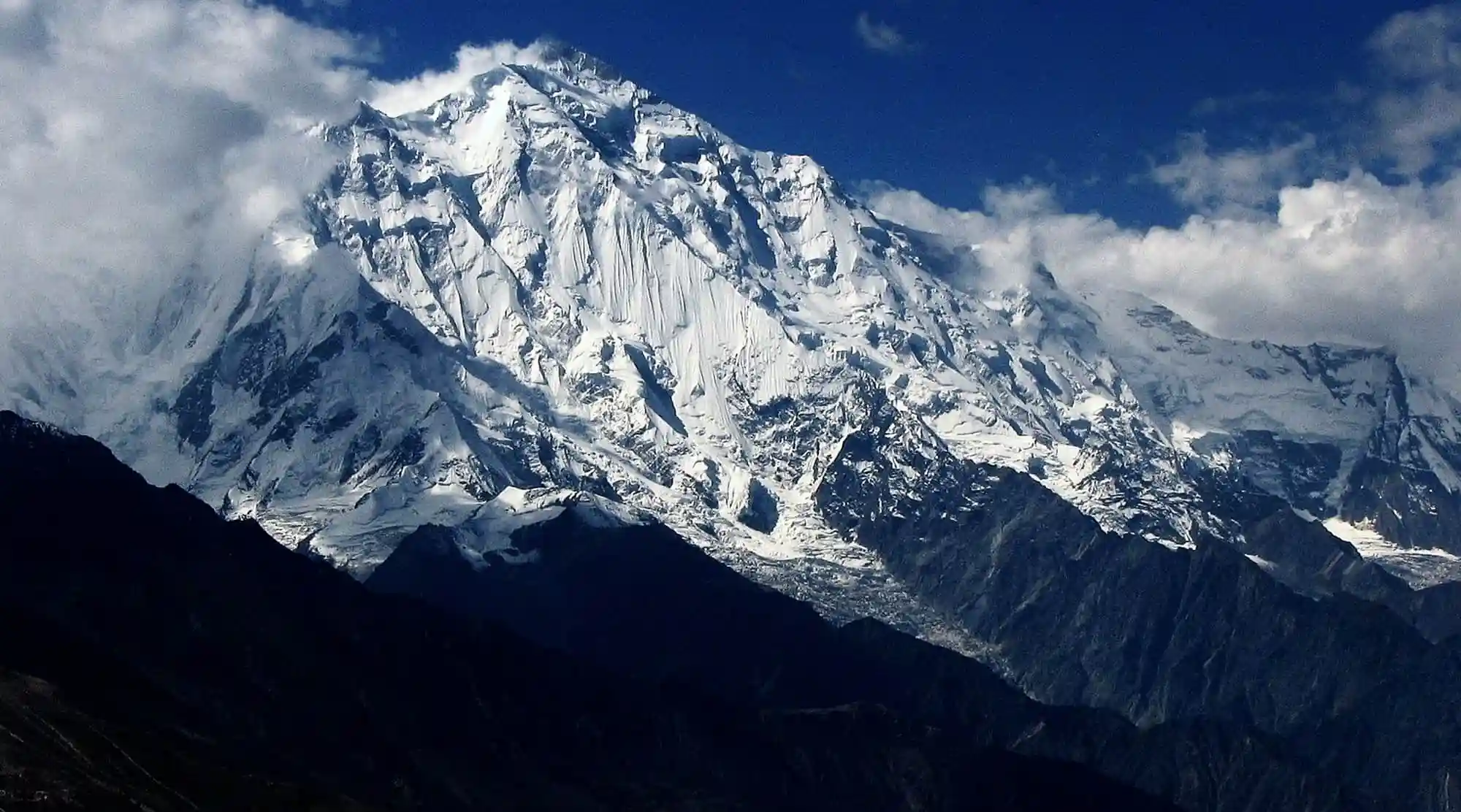
    Nestled in the heart of Hunza Valley, one of the most picturesque regions in northern Pakistan, Rakaposhi is a majestic peak that beckons adventurers worldwide. Towering at 7,788 meters (25,551 feet), Rakaposhi Mountain is the 27th highest peak in the world, making it a prized destination for trekkers, mountaineers, and nature enthusiasts. With its ice-clad slopes and towering glaciers, this stunning peak offers an unforgettable experience for those brave enough to conquer its base camp.

    This blog will explore Rakaposhi, its history, how to reach it, what to expect on the trek, the surrounding beauty, and all the essential information that will guide you on your adventure to this iconic peak.

    Introduction to Rakaposhi: The Jewel of Hunza

    Rakaposhi, which means “snow-covered” in the local language, is the pride of Hunza Valley. With its pristine snowfields and steep ridges, it stands as a perfect testament to the raw beauty of the Hindu Kush Mountains. While Rakaposhi is often overshadowed by larger peaks like K2 or Nanga Parbat, it remains a must-see for trekkers who want to experience the rugged grandeur of Pakistan’s northern wilderness.

    The Rakaposhi peak dominates the Hunza skyline, and the journey to its base camp is filled with extraordinary landscapes, warm hospitality, and a sense of tranquility that is hard to find elsewhere. It’s not just a trek; it’s an expedition through a land that feels like a forgotten world, where nature is in its most pristine form.

    How to Reach Rakaposhi: Starting Your Journey

    The journey to Rakaposhi Base Camp begins from Karimabad, the main town in Hunza Valley. The quickest way to reach Karimabad is by flying into Gilgit, which is well-connected by flights from Islamabad. The flight into Gilgit offers stunning views of the Hindu Kush and Karakoram ranges, setting the tone for the journey ahead.

    Once you arrive in Gilgit, you will need to take a scenic 2-3 hour drive along the Karimabad Road, which passes through lush valleys, small villages, and towering mountain landscapes. The drive is an experience as you wind through the beautiful landscapes of Hunza.

    Rakaposhi Base Camp

    Nearby Attractions in Hunza Valley

    Before you embark on your Rakaposhi Trek, explore the enchanting Hunza Valley. Known for its mesmerizing views, rich culture, and charming villages, this region is a treasure trove of natural wonders. Here are some top attractions to check out:

    • Baltit Fort: An ancient fort dating back over 700 years, offering panoramic views of Hunza Valley.
    • Altit Fort: Another historical site in Hunza, providing insights into the region’s culture and architecture.
    • Eagle’s Nest: A must-visit spot for breathtaking views of Rakaposhi, Nanga Parbat, and several other peaks in the Hindu Kush range.
    • Husseini Suspension Bridge: Known as one of the most dangerous suspension bridges in the world, this is a thrilling experience for adventure seekers.

    Hunza Valley offers a perfect blend of nature, history, and adventure, making it a great destination before trek to Rakaposhi.

    The Rakaposhi Trek: What to Expect

    The Rakaposhi Trek is a challenging but rewarding journey that takes trekkers through rocky trails, grassy meadows, and alpine forests, eventually reaching the Rakaposhi Base Camp at an altitude of about 4,800 meters (15,748 feet). The trek usually takes around 8 to 10 days to complete, depending on your pace, and is perfect for those with a moderate level of trekking experience.

    Day 1: Karimabad to Rakaposhi Base Camp

    Your journey begins in Karimabad, where you will meet your trekking crew and begin the drive towards Minapin, the starting point of the trek. The road to Minapin is bumpy but scenic, offering spectacular views of the Hunza River and the surrounding mountains. After reaching Minapin, the trek to Rakaposhi Base Camp begins.

    The first day of the trek is an easy walk through the Minapin village and along a well-marked trail that passes through cedar trees and oak forests. You will reach the first camp by the evening at Tupopdan, where you can rest and enjoy the stunning views of Rakaposhi’s massive snow-capped slopes.

    Day 2-3: Tupopdan to Rakaposhi Base Camp

    The landscape changes as you continue your trek, and the path becomes steeper. The Rakaposhi Glacier will be your constant companion, and the trek is filled with incredible views of Rakaposhi’s north face. The base camp, located at 4,800 meters, offers an up-close view of the glacier and the towering summit of Rakaposhi. The area is a photographer’s paradise, with snow-capped peaks, glaciers, and rushing streams creating a serene and awe-inspiring atmosphere.

    rakaposhi mountain
    rakaposhi mountain

    Day 4: Explore Rakaposhi Base Camp

    Spend the day exploring the surroundings of Rakaposhi Base Camp. The views from here are breathtaking, with Rakaposhi towering above you in all its majesty. You can take short hikes to explore the area further or relax and take in the beauty of the mountains. If you’re feeling adventurous, you can hike further up the glacier or take in the panoramic views of the region’s Husseini Glacier and other peaks.

    Day 5-6: Trek Back to Minapin

    The trek back to Minapin follows the same route but with the satisfaction of completing a thrilling and unforgettable journey. As you descend, the terrain gradually becomes less challenging, and you’ll have the opportunity to take the landscape differently.

    What Makes Rakaposhi Special

    Breathtaking Scenery

    The Rakaposhi Base Camp Trek offers some of Pakistan’s most stunning mountain landscapes. Rakaposhi’s views are mesmerizing, especially from Eagle’s Nest, where you can see the mountain in all its glory. The trek takes you through alpine meadows, glaciers, and high-altitude ridges, offering a unique blend of natural beauty and challenging terrain.

    Moderate Difficulty Level

    While Rakaposhi is a high-altitude trek, it is considered moderately difficult compared to other treks in Pakistan. The route is less technical than K2 Base Camp or Nanga Parbat, making it accessible for trekkers with experience at higher altitudes. However, altitude sickness is still a concern, and trekkers should ensure they acclimatize properly before reaching the base camp.

    Cultural Immersion

    The trek also offers a unique opportunity to immerse yourself in the culture of Hunza. Along the way, you’ll encounter local communities that have lived in the region for centuries. The people of Hunza are known for their warmth and hospitality and often share stories of their traditions, history, and culture.

    rakaposhi view point
    rakaposhi view point

    Rakaposhi Weather and Best Time to Visit

    The best time to visit Rakaposhi is between June and September when the weather is relatively stable and the trails are accessible. During this period, the temperatures at Rakaposhi Base Camp are mild, ranging from 5°C to 15°C during the day and dropping significantly at night.

    It’s important to note that the weather in the mountains can be unpredictable, and trekkers should always be prepared for sudden weather changes, including snow and rain.

    Rakaposhi Trek Cost

    The cost of the Rakaposhi Trek can vary depending on your preferred travel arrangements and trekking company. On average, the trek can cost anywhere from $1,000 to USD 2,000 for a guided trek, which includes transportation, permits, food, and accommodations.

    Nearby Attractions to Explore

    Once you complete your Rakaposhi trek, you can continue exploring the breathtaking Hunza Valley and its surroundings. A few must-visit places include:

    • Khunjerab Pass: The highest paved border crossing in the world, located at the border between Pakistan and China. This pass offers stunning views of snow-capped peaks.
    • Passu Cones: Unique, pointed peaks that rise dramatically above the Hunza Valley, perfect for trekking and photography.
    • Naltar Valley: A hidden gem known for its lush green landscapes and serene lakes, perfect for a quiet getaway.

    Conclusion

    Rakaposhi is more than just a mountain; it’s a journey into the heart of Hunza Valley and one of the most rewarding treks in the world. From the stunning landscapes to the rich culture and welcoming people, Rakaposhi Base Camp is an adventure that will leave you in awe. Whether you’re a seasoned trekker or someone seeking a new challenge, the Rakaposhi trek is an experience you will cherish forever.

    Prepare yourself for an unforgettable journey to Rakaposhi, where you will conquer the heights of one of Pakistan’s most iconic peaks and create memories that will last a lifetime.

  • Lady Finger Peak: Beauty of the Karakoram Range

    Lady Finger Peak: Beauty of the Karakoram Range

    Rising majestically in the heart of the Karakoram Range, Lady Finger Peak (also known as Mir Peak) is one of the most striking and distinctive mountains in northern Pakistan. Standing at an impressive height of 6,000 meters (19,685 feet), Lady Finger Peak offers trekkers and mountaineers an unforgettable adventure with stunning views, unique geological features, and a glimpse into the remote beauty of the region. This mountain is not only a paradise for climbers but also a captivating destination for travelers wishing to witness the Karakoram Range’s magnificence.

    Whether you are an experienced trekker or a casual traveler, the beauty and allure of Lady Finger Peak are bound to captivate your heart. This blog will guide you through everything you need about Lady Finger Peak, including how to reach it, what to expect during your trek, nearby attractions, and more.

    Introduction to Lady Finger Peak

    Lady Finger Peak is a prominent mountain in the Hunza Valley of Gilgit-Baltistan, known for its breathtaking landscapes and majestic peaks. Its unique shape, which resembles a finger pointing towards the sky, is the primary reason it has earned the name “Lady Finger.” The peak stands proudly among the towering giants of the Karakoram Range, and its striking silhouette has become an iconic symbol of the region.

    The Lady Finger Peak’s height of 6,000 meters makes it an accessible yet challenging climb, ideal for trekkers who wish to experience the rugged beauty of the Karakoram without attempting the extreme heights of nearby peaks like K2 or Nanga Parbat. The surrounding area is equally captivating, offering lush valleys, ancient forts, and a unique cultural heritage, making this destination even more special.

    Where is Lady Finger Peak Located?

    Lady Finger Peak is present in Pakistan, specifically in the Hunza Valley, which is situated in the Gilgit-Baltistan region of northern Pakistan. The peak is part of the Karakoram Range, one of the world’s most famous and rugged mountain ranges, known for its towering peaks and dramatic landscapes. The location of Lady Finger Peak in Hunza makes it a central part of one of the country’s most beautiful and remote areas. It is often a highlight for trekkers and mountaineers visiting the region.

     lady finger peak

    How to Reach Lady Finger Peak

    Reaching Lady Finger Peak requires you to first travel to Hunza, the picturesque valley in the Gilgit-Baltistan region. Here’s how you can make your way to the base of this iconic peak:

    By Air: Islamabad to Gilgit

    The most convenient way to reach Hunza is by flying into Gilgit. Pakistan International Airlines (PIA) offers flights from Islamabad to Gilgit usually take an hour. The journey offers stunning views of the Hindu Kush and Karakoram Ranges, previewing the majestic peaks you’ll encounter during your trek.

    By Road: Gilgit to Hunza

    Once in Gilgit, you can travel by road to Hunza, about 2 to 3 hours away. The scenic drive through the winding roads of the Karakoram Highway (known as the Eighth Wonder of the World) provides spectacular views of rivers, valleys, and towering peaks. Along the way, you will pass through quaint villages, picturesque landscapes, and clear blue skies, making the journey an adventure.

    Trekking to Lady Finger Peak

    Once you arrive in Hunza, the trek to Lady Finger Peak begins. The base camp for the trek is located at Husseini Village, and from there, trekkers typically head towards Borith Lake, which is one of the starting points of the hike. The trek offers dramatic views of Lady Finger Peak and the surrounding mountains. It is a relatively short yet challenging trek that takes around 2 to 3 days to complete, depending on your pace.

    What to Expect on the Lady Finger Peak Trek

    The Lady Finger Peak trek is one of the most rewarding experiences in the Karakoram Range, offering trekkers the chance to explore the natural beauty of Hunza while challenging themselves with high-altitude trekking. The trek is moderately difficult and is suitable for those with a good level of fitness and some experience with high-altitude treks.

    Day 1: Hunza to Borith Lake

    The journey begins in Hunza, where you will head towards Borith Lake, a serene alpine lake nestled at about 2,600 meters (8,530 feet). The trek to Borith Lake takes around 3 to 4 hours, and the stunning views of Lady Finger Peak begin to unfold as you ascend. The lake is a peaceful spot to relax and enjoy the magnificent surroundings.

     lady finger peak expedition

    Day 2: Borith Lake to Lady Finger Base Camp

    On the second day, you will continue the trek toward the Lady Finger Base Camp at a higher altitude. The trail is rugged, passing through rocky terrain and alpine meadows, with Lady Finger Peak always visible in the distance. The views become even more breathtaking as you climb higher, with the Karakoram Range stretching out before you. The night at base camp is spent under the stars, with the towering peaks providing a dramatic backdrop.

    Day 3: Summit Attempt (Optional) and Return to Borith Lake

    For those who wish to summit Lady Finger Peak, the final ascent begins early in the morning. The summit climb is more challenging, requiring climbing gear and experience in alpine environments. However, for trekkers who prefer not to summit, a shorter hike to the Gulmit Glacier or a nearby viewpoint will still offer stunning vistas of Lady Finger Peak and the surrounding valleys. After a rewarding day of exploration, trekkers return to Borith Lake for a well-deserved rest.

    What Makes Lady Finger Peak Special?

    A Unique and Iconic Shape

    One of the most distinctive features of Lady Finger Peak is its unique, slender shape. The peak is often described as resembling a finger pointing skyward, which is how it earned its name. The striking appearance of the peak makes it an iconic landmark of the Karakoram Range, and it has become one of the most photographed mountains in the region. The peak’s visual appeal draws trekkers and photographers worldwide, eager to capture its beauty.

    Stunning Views of the Karakoram Range

    While Lady Finger Peak is relatively smaller than some of the giants of the Karakoram Range, its position in the valley provides stunning panoramic views of the surrounding peaks. Trekkers from the base camp and summit can see peaks such as Rakaposhi, Ultar Sar, and Batura Sar, among the highest mountains in the world. The views are a photographer’s dream, offering dramatic scenes of jagged peaks, glaciers, and deep valleys.

    lady finger peak in pakistan
    lady finger peak in pakistan

    Accessibility for Trekkers

    Unlike other high-altitude peaks in the Karakoram Range, such as K2 or Nanga Parbat, Lady Finger Peak is much more accessible for trekkers. The trek to Lady Finger Peak doesn’t require advanced technical skills, making it an excellent choice for those who want to experience the rugged beauty of the Karakoram without attempting a challenging summit. It is an ideal destination for trekkers with moderate experience and a desire to witness the grandeur of this incredible mountain range.

    A Cultural and Historical Journey

    Beyond its natural beauty, the Lady Finger Peak trek also offers trekkers the opportunity to immerse themselves in the culture and history of Hunza. The Hunza Valley is home to a unique and welcoming community known for its warm hospitality, traditional lifestyle, and rich cultural heritage. While trekking, you will pass through villages that showcase the history and heritage of this region, from ancient forts like Baltit Fort and Altit Fort to the timeless traditions of the people who call this valley home.

    Best Time to Visit Lady Finger Peak

    The best time to trek to Lady Finger Peak is during the summer months, from June to September. The weather is relatively stable during this period, with clear skies and moderate temperatures. The daytime temperatures range between 15°C to 25°C, while the nights can get cold, especially at higher altitudes. Trekking during the summer months ensures the trail is clear of snow and ice, making it safer and more enjoyable.

    Nearby Attractions to Explore

    Once you’ve completed the trek to Lady Finger Peak, there are several nearby attractions worth visiting:

    • Hunza Valley: Known for its beautiful landscapes and rich culture, Hunza is a popular tourist destination. Visitors can explore the historic Baltit Fort and Altit Fort and enjoy panoramic views of the surrounding peaks at Eagle’s Nest.
    • Borith Lake: A serene and picturesque alpine lake that offers a peaceful retreat amidst stunning landscapes.
    • Naltar Valley: Famous for its lush forests, scenic lakes, and green meadows, Naltar is a hidden gem in the Gilgit-Baltistan region, perfect for relaxation after your trek.

    Conclusion

    The Lady Finger Peak trek is a must-do for anyone visiting the Karakoram Range. With its unique and iconic shape, stunning views, and accessibility for trekkers, Lady Finger Peak offers an unforgettable experience for those seeking adventure, natural beauty, and cultural immersion. Whether you are trekking to the summit or simply enjoying the surrounding landscapes, the Lady Finger Peak trek will provide you with a deep connection to one of the most majestic mountain ranges in the world.

Translate »

Proceed Booking